


NASA’s vast archive of Earth observation data has long been a cornerstone for scientific discovery, environmental monitoring, and global sustainability efforts. Now, Microsoft has made it even easier for researchers, developers, and decision-makers to access and utilize this critical resource. Through a collaboration with NASA, the Harmonized Landsat and Sentinel-2 (HLS) dataset is now available on Microsoft Azure by using Microsoft’s Planetary Computer platform.
Whether you’re a researcher looking to push the boundaries of climate science, an entrepreneur exploring new commercial applications, or a scientist developing cutting-edge tools for agriculture, water resource management, or sustainable land use, NASA’s HLS data in Azure provides a foundation for next-generation Earth observation capabilities.
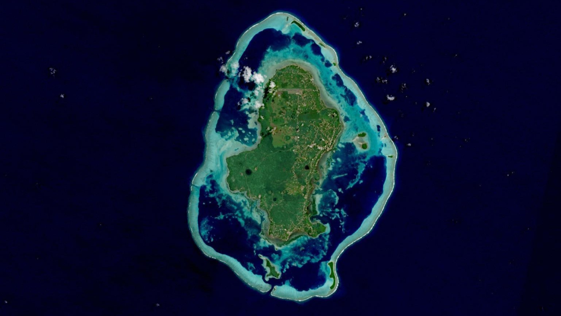 The island of Uvea (Wallis) of Wallis and Futuna can be seen in this true-color Harmonized Landsat Sentinel-2 reflectance image captured on April 29, 2025, by the Multispectral Imager (MSI) instrument aboard the Sentinel-2B satellite. Image Credit: NASA Worldview
Unlocking the Power of HLS Data in the Cloud
Microsoft Planetary Computer is a platform providing access to a multi-petabyte catalog of global environmental data presented in consistent, analysis-ready formats. Users can access the data through APIs and directly via Azure Storage. This flexible scientific environment allows users to answer questions about the data, and both build applications and use applications on top of the platform.
The HLS dataset is funded by NASA and designed to respond to the needs of the U.S. federal government identified by the Satellite Needs Working Group (SNWG) biennial survey to provide a seamless set of surface reflectance records from the USGS/NASA Operational Land Imager (OLI) aboard the NASA/USGS Landsat-8/9 and Multi-Spectral Instrument (MSI) aboard the European Space Agency’s Sentinel-2A/B remote sensing satellites. By harmonizing these datasets, NASA provides a continuous, high-resolution view of our planet, which allows for better analysis of land use changes, vegetation health, water resources, and more.
With HLS data hosted on Microsoft Azure and available via Microsoft Planetary Computer, users can scale complex environmental computations and apply Microsoft’s advanced AI and cloud-based analytics to drive innovation across industries.
Innovate with AI and Cloud-Based Analytics
For example, developers and researchers can use Azure OpenAI Service and Microsoft Planetary Computer to create intelligent applications that enhance Earth observation analysis. Already, NASA IMPACT and Microsoft have worked together to create a prototype NASA Earth Copilot, an AI-powered assistant that helps scientists and policymakers discover, interpret, and analyze geospatial data using natural language queries.
Earth Copilot enables users to interact with NASA data hosted in Azure repository through plain language queries. Instead, they can simply ask questions such as “What was the impact of Hurricane Ian in Sanibel Island?” or “How did the COVID-19 pandemic affect air quality in the US?” AI will then retrieve relevant datasets, making the process seamless and intuitive.
In short, Azure cloud and AI tools help researchers spend less time on data retrieval and more on analysis and discovery. It also opens the door wider for educators to more easily engage students in Earth Science, and policymakers to more easily make informed decisions on critical issues like climate change, urban development and disaster preparedness.
By combining HLS data with Azure AI, machine learning, and high-performance computing services, users can:
- Automate land cover classification and vegetation monitoring
- Detect changes in urban development and deforestation trends
- Develop AI models to predict environmental patterns
- Create interactive geospatial applications that simplify decision-making
Whether you’re a researcher looking to push the boundaries of climate science, an entrepreneur exploring new commercial applications, or a scientist developing cutting-edge tools for agriculture, water resource management, or sustainable land use, NASA’s HLS data in Azure provides a foundation for next-generation Earth observation capabilities.
Get Started Today
The power of NASA’s Earth observation data is now at your fingertips. To begin leveraging HLS data on the Microsoft Planetary Computer, visit the dataset’s landing page and explore how you can integrate it with Azure’s AI, machine learning, and data analytics tools.
Microsoft and NASA also offer comprehensive training resources to help you make the most of these capabilities. Learn how to build AI-powered applications using Azure OpenAI, process geospatial data efficiently, and deploy scalable solutions in the cloud:
- Build your own Earth Copilot in Azure to navigate Geospatial Data: https://github.com/microsoft/Earth-Copilot/
- Explore HLS Data on Microsoft Planetary Computer Using GitHub Copilot: https://github.com/microsoft/HLS-PlanetaryComputer-Copilot
- Microsoft Planetary Computer Pro (Public Preview): https://aka.ms/planetarycomputerpro
- Learn more about HLS data and its applications in a new NASA Earthdata blog post: https://www.earthdata.nasa.gov/news/blog/harmonized-landsat-sentinel-2-hls-data-now-available-microsofts-planetary-computer
🚀 Start exploring NASA’s HLS data today and unlock new possibilities with AI and cloud computing. Visit Microsoft’s Planetary Computer and begin your journey toward the future of Earth science innovation.
0 comments